Unveiling Black History Through GIS: Mapping Green Book Locations
In commemoration of Black History Month, I embarked on a unique project utilizing Geographic Information Systems (GIS) to archive historical sites documented in Victor Green’s Green Book. Published in 1936, the Green Book served as a vital guide for Black travelers, offering safe havens and essential services along their journeys in a segregated America. In this post, we delve into the significance of GIS in preserving this crucial aspect of Black history.
Inspiration inspired me after reading Isabel Wilkerson’s "The Warmth of Other Suns," which vividly recounts the Great Migration, a monumental movement where millions of Black Americans sought refuge from the oppressive conditions of the South. As I delved into their narratives of resilience and fortitude, I considered the challenges they faced in finding safe accommodations and services amidst the prevalent Jim Crow laws. My search for maps or resources pinpointing Green Book locations yielded little to no results, prompting me to initiate this project.
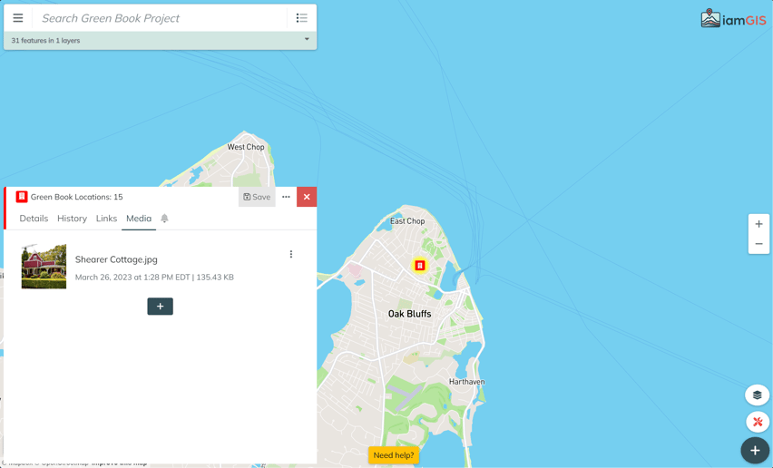
The goal was clear: leverage GIS to create an interactive map showcasing both existing and forgotten establishments listed in the Green Book. These locations, ranging from motels to tourist homes, not only offered lodging but also encompassed essential amenities such as restaurants, gas stations, barbershops, and banks, forming the backbone of Black travelers' networks. Through detailed layering and data structuring, I carefully charted each site, documenting vital details such as construction dates, mentions in the Green Book, and preservation status.
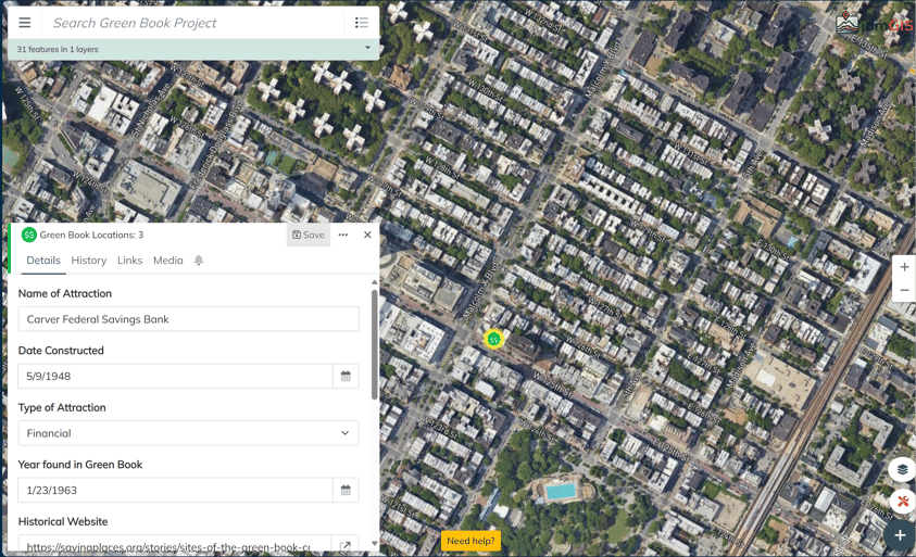
For sites preserved by esteemed organizations like the National Trust for Historic Preservation, I provided URLs directing users to further historical insights. Additionally, I compiled a collection of digital resources, including archived Green Books from the New York Public Library, enriching the narrative with visual and textual depth. Each location, whether preserved or lost to time, was presented with context through historical photographs depicting its heyday and contemporary appearance.
In conclusion, this ongoing project serves as a poignant testament to the resilience and ingenuity of Black Americans throughout history. By immortalizing these waypoints of safety and solidarity, we not only honor the courage of travelers but also celebrate the hospitality of those who opened their doors when faced with adversity. My vision is to expand this initiative to encompass Green Book locations across every state, ensuring that this vital chapter of American history remains accessible and revered.
To explore the Green Book map and delve deeper into its significance, please follow this link.
For additional information on the Green Book, visit:
Join us in preserving and honoring this invaluable aspect of Black history.