Enhancing Event Organization with iamGIS
Although we’re at the beginning of the year, it’s never too early to start planning for upcoming events. iamGIS stands as a remarkable tool, not only for asset and facility management but also as a useful resource for event management within any city or organization. This post aims to explore the ways iamGIS can improve event organization, providing insights into managing events efficiently and ensuring public awareness.
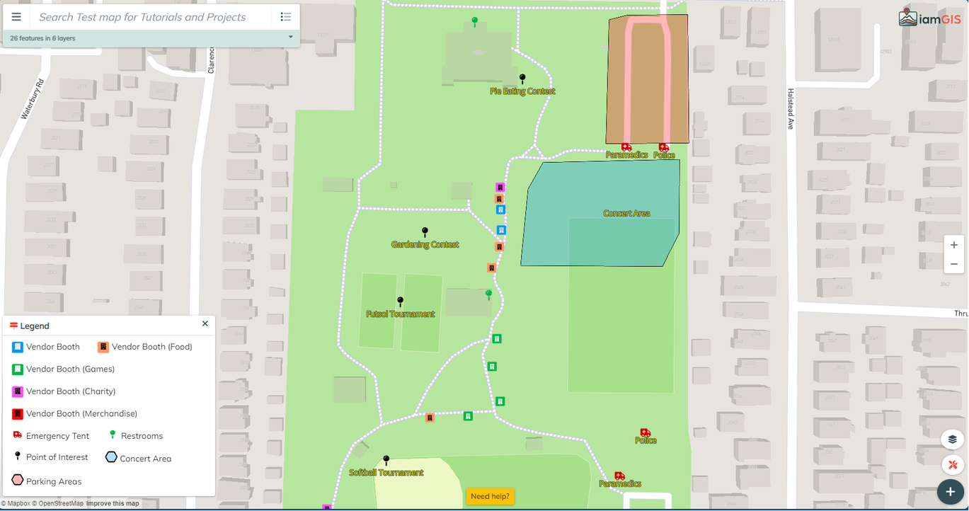
Creating Unique Maps and Layers for your event. With iamGIS, create a separate map away from critical infrastructure that can be used by event organizers and the public. Create layers for the event, showing where food stands and merchandise can be found. Inform the public where events and emergency services can be found. Those layers can then be customized to include important detail information that will keep staff and the public informed. Include when the event begins, and when the food vendor closes their stall.
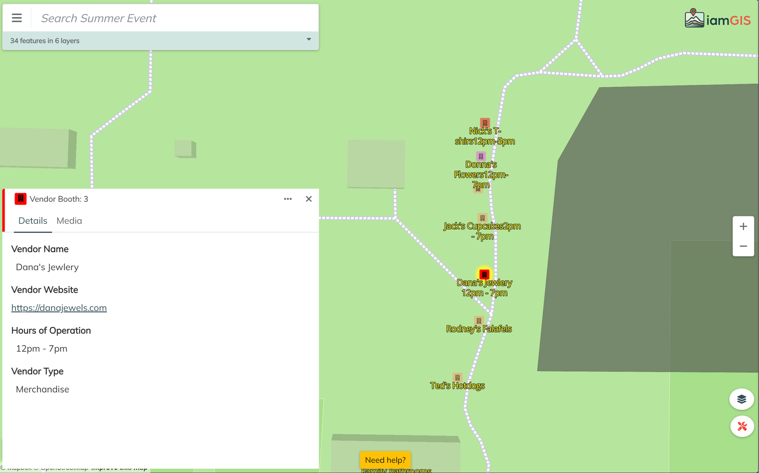
For event organizers, creating view only accounts for staff allow them to view detail information that won’t be included on the public facing map. Creating a vendor layer allows you to attach relevant files. such as receipts and contracts, in the media tab. This can enhance accessibility, enabling organizers to swiftly retrieve crucial information. This layer gives users the ability to set reminders for vendor booths, allowing for timely check-ins to ensure operational smoothness. Create fields that tell the vendor’s business, website and the hours their booth will be open. Add a field to tell what type of vendor it is, adding an additional level of description to the map legend. Set up symbology to change based off the type of vendor it is. Color conditions can be set based off the color. Showing Food vendors as orange and carnival game booths as green. Turn on labels within map settings to allow the public to see vendor and invite names and times without giving them access to details that might only be for organizers.
Sharing a public-facing event map serves as an invaluable resource for attendees, enabling them to navigate the event seamlessly. This map can showcase vendor locations and attractions, providing visitors with the ability to plan their event experience efficiently. Essential landmarks like restrooms, emergency services, and information booths are highlighted as layers, enhancing attendee convenience. Unlike traditional paper maps that necessitate significant lead time for alterations before printing, web-based maps can be updated in real-time up to the event's commencement. The flexibility of web maps allows for instantaneous modifications, ensuring that all changes reflect instantly for anyone accessing the link. Post-event, the link can be disabled, providing a dynamic yet temporary resource for attendees.

With user creativity and customization, iamGIS can be an indispensable tool for event management, offering unparalleled flexibility and efficiency. From creating custom maps for an upcoming event to creating public facing maps for the community. iamGIS not only optimizes event logistics but also underscores its significance as a flexible solution for modern event planning within cities and organizations alike.